Logo courtesy of Lindsey Electric; Radio 731 logo courtesy of Forever Communications; Image, Shutterstock
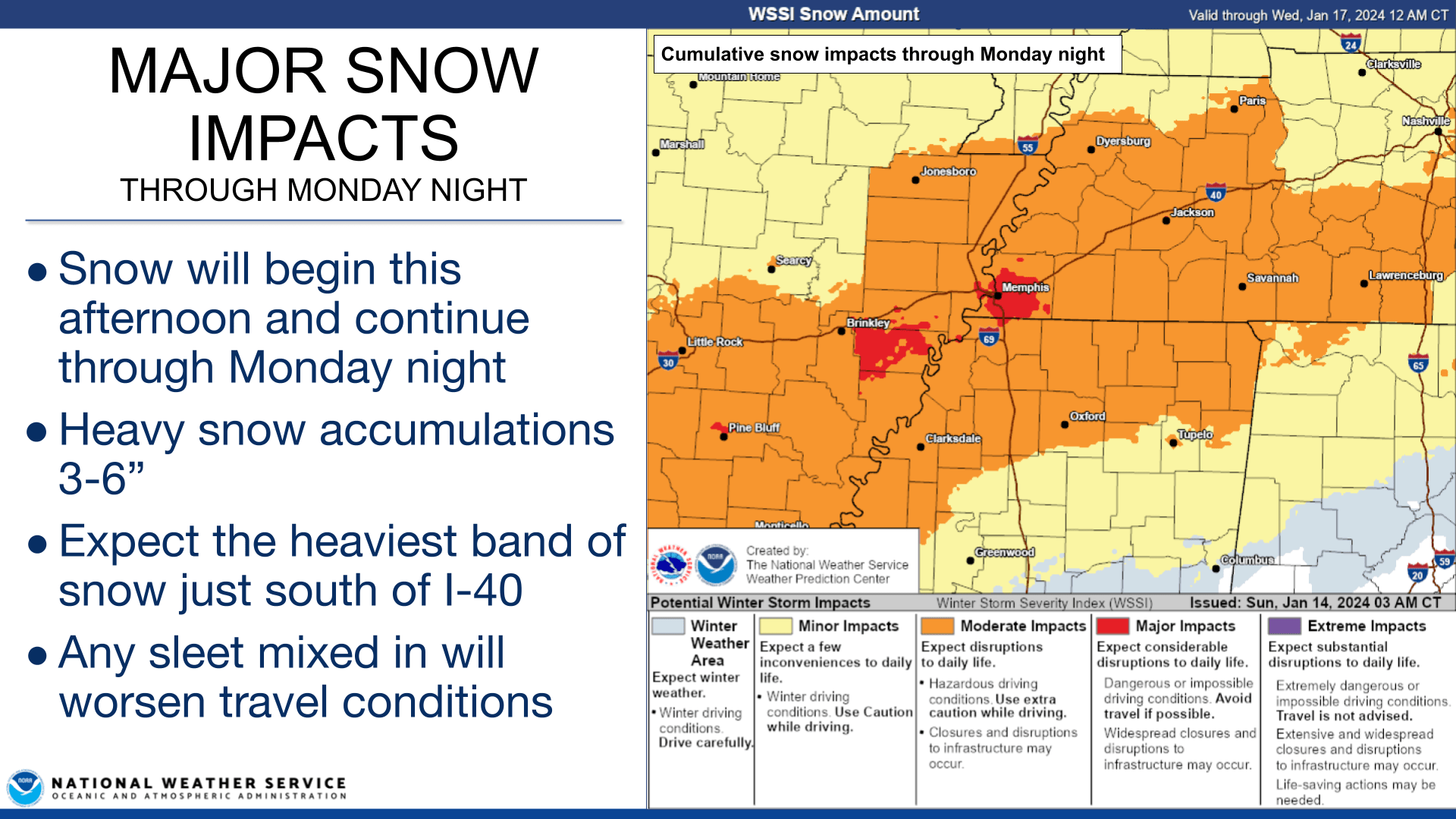
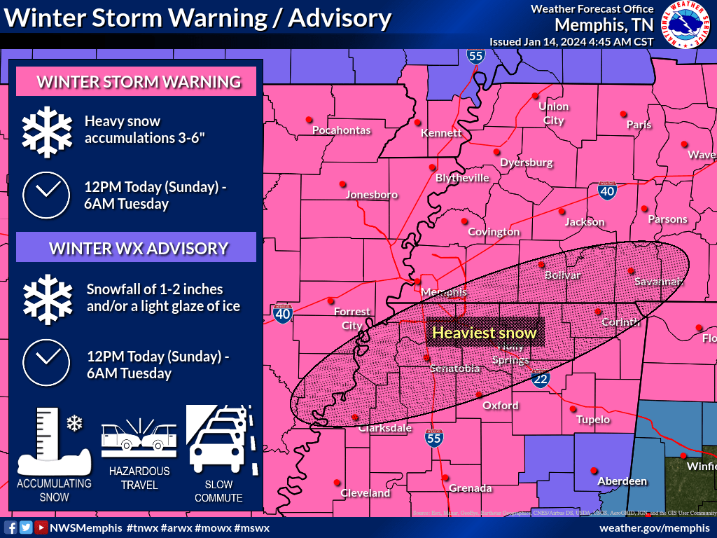
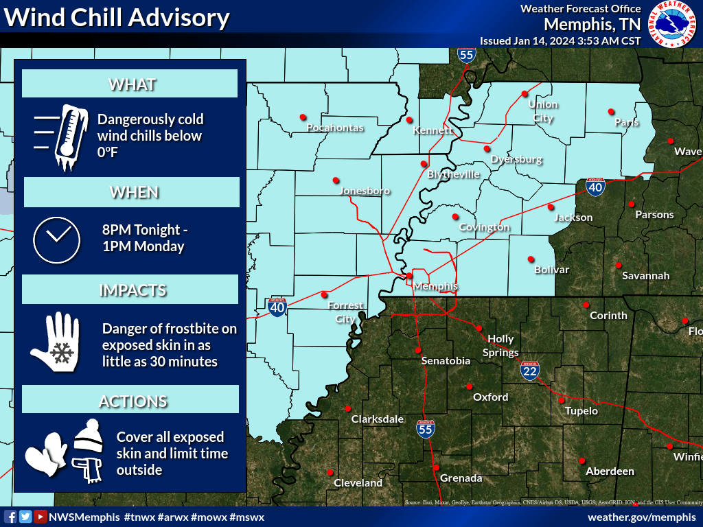
Winter Storm Warnings are now in effect for heavy snow accumulations totaling 3 to 6 inches through Monday night, according to the National Weather Service in Memphis. Wind Chill Advisories are also in effect (and will continue to be needed all week) for sub-zero wind chills.
Sunday, January 14:
- Snow will start to move in this afternoon, NWS said and will continue through Monday night
- Travel conditions will be hazardous, with reduced visibilities expected tonight
- A band of heavy snow is expected to set up just south of the I-40 corridor tonight
- Areas south of I-22 may see a mix of snow/sleet/freezing rain tonight
- Wind chills will drop below zero tonight along and north of I-40
Monday, January 15:
- Bitter cold early morning sub-zero wind chills
- Snow will continue all day, finally ending by midnight Tuesday
- Travel conditions will worsen throughout Monday
- Another round of mixed precip (snow/sleet/freezing rain) may impact the same areas of north Mississippi in the afternoon
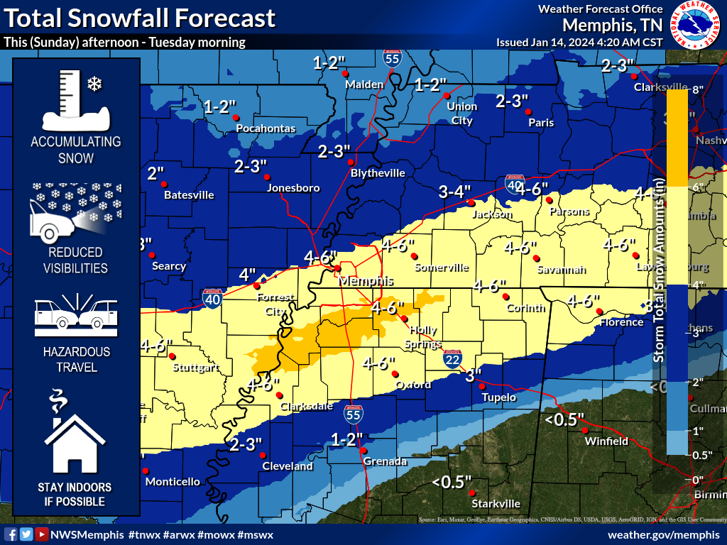
- NWS said total snowfall accumulations through midnight Tuesday are widespread 3 to 6 inches, but there may be pockets along the heaviest snow band (see total snowfall graphic) of up to 8 inches
- Any sleet mixing into the snow will worsen travel conditions even further
Forecast for the rest of this week:
- Bitter cold wind chills daily
- Tuesday morning will be the coldest with widespread wind chills between 0°F and -10°F
- Temperatures will not rise above freezing at all until Thursday afternoon (This will keep snow/ice on the roads frozen all week. Hazardous travel conditions will likely last for several days)
Our severe weather coverage is sponsored by Lindsey Electric, your Generac generator dealer in Jackson. Call 731-423-1580, or visit Lindsey Electric Service dot com. Lindsey Electric – The authority for your power solutions.