Logo courtesy of Lindsey Electric; Radio 731 logo courtesy of Forever Communications; Image, Shutterstock
A very active weather pattern awaits the Mid-South after Thursday, from storms to snow, according to Phil Baker, lead meteorologist at The National Weather Service in Memphis.
In a Thursday morning message, Baker stated that “Thunderstorms will move into the Mid-South during the pre-dawn hours Friday, potentially enhancing the already strong winds and presenting a brief tornado threat southwest of Tupelo through midmorning. After storms exit, strong winds will continue across the Midsouth Friday afternoon. A Wind Advisory is currently in effect. An update to High Wind Warning is possible.
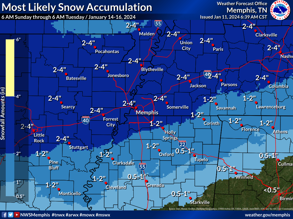
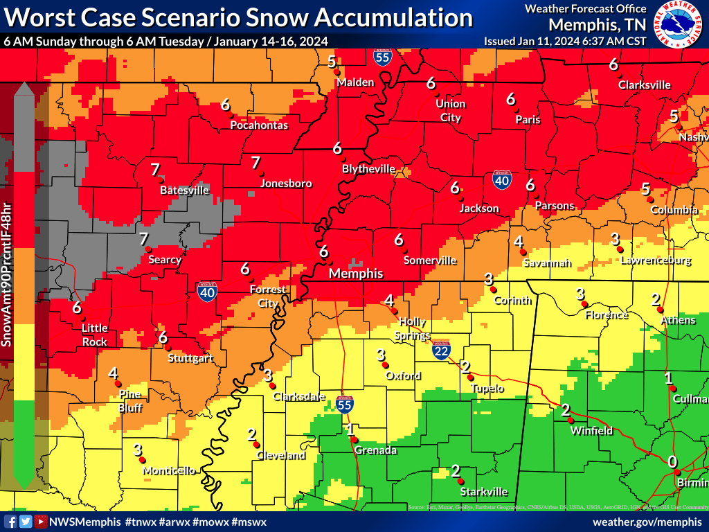
An Arctic cold front will arrive Saturday night, followed by developing snow north of I-40 Sunday afternoon and evening. Snow will develop further south late Sunday night, affecting the I-40 corridor and Memphis. Snow will taper off Monday, with only minor additional accumulations expected.
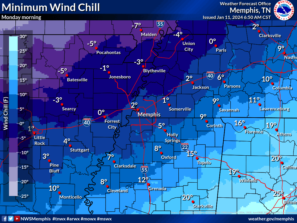
Bitter cold wind chills will prevail Sunday night through Wednesday morning. Tuesday morning will be the coldest, with wind chills of -5 to -15 degrees expected across the Mid-South.
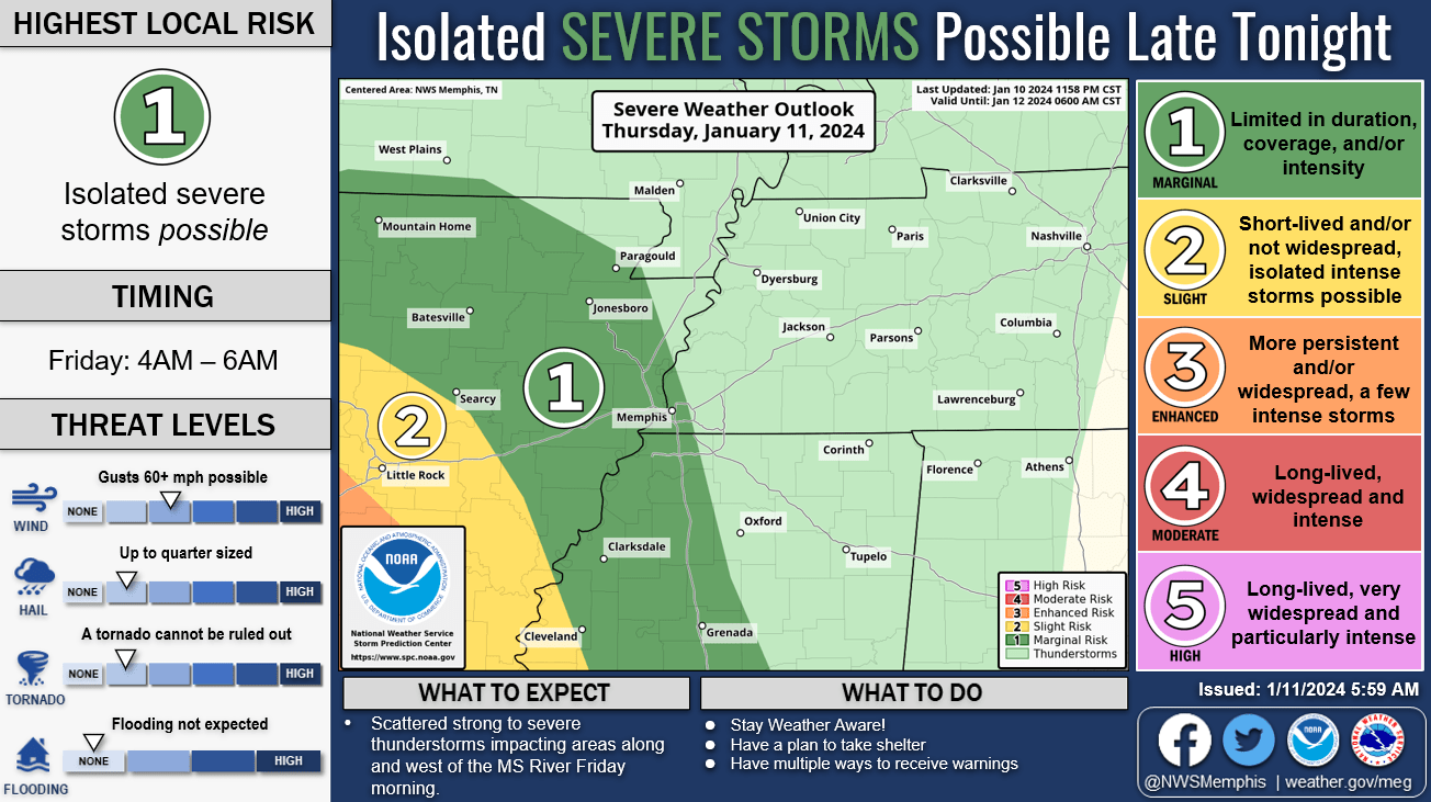
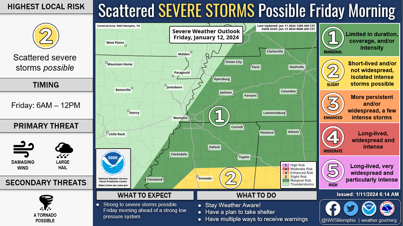
Friday January 12:
- Severe weather chances increase after 4 AM
- Primary threat: Damaging winds, small hail
- Secondary threat: Tornadoes
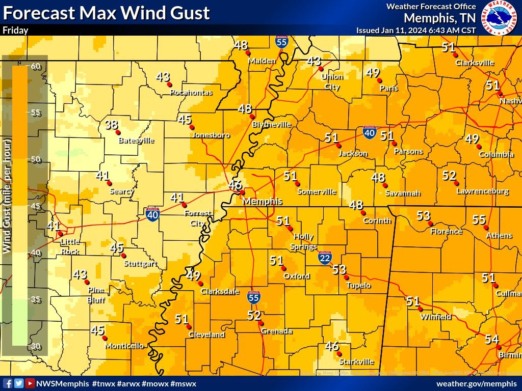
- Strong non-thunderstorms winds will occur areawide Friday.
Sunday January 14:
- Snow will begin in the afternoon north of I-40, reaching peak intensity Sunday evening. Temperatures will continue to plunge as Arctic air deepens
Monday January 15 – Wednesday January 17:
- Additional minor snow accumulations possible Monday, mainly along and south of Interstate 40.
- Bitterly cold conditions continue through Wednesday morning. Conditions could be life-threatening to those without shelter.
Confidence:
Medium (3/5) for severe thunderstorm impacts Friday
High (5/5) for wind impacts Friday
Medium-High (4/5) for snow accumulation impacts Sunday and Monday
High (5/5) for temperature impacts Sunday through Wednesday
Medium (3/5) for severe thunderstorm impacts Friday
High (5/5) for wind impacts Friday
Medium-High (4/5) for snow accumulation impacts Sunday and Monday
High (5/5) for temperature impacts Sunday through Wednesday
Our severe weather coverage is sponsored by Lindsey Electric, your Generac generator dealer in Jackson. Call 731-423-1580, or visit Lindsey Electric Service dot com. Lindsey Electric – The authority for your power solutions.