Logo courtesy of Lindsey Electric; Radio 731 logo courtesy of Forever Communications; Image, Shutterstock
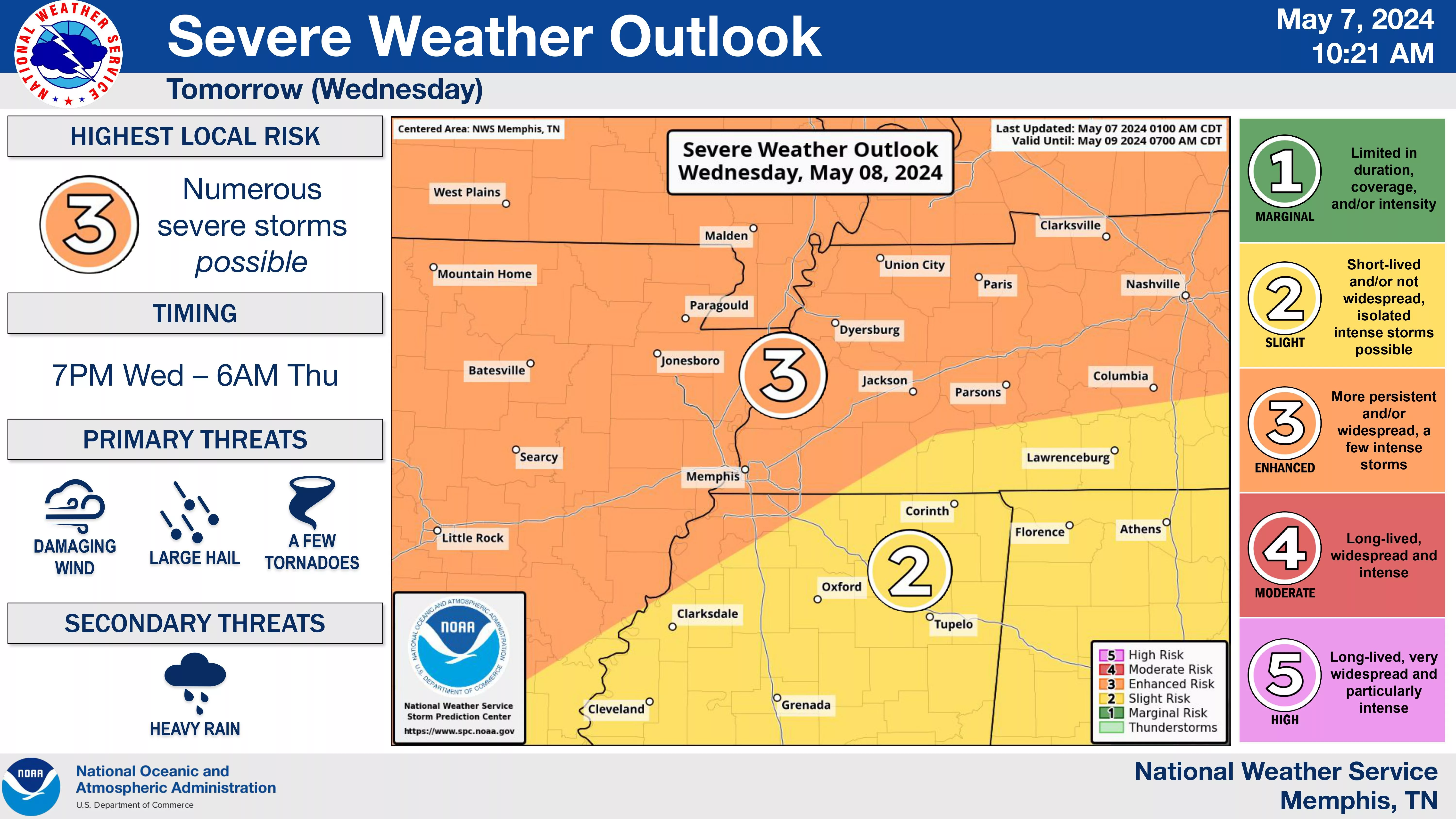
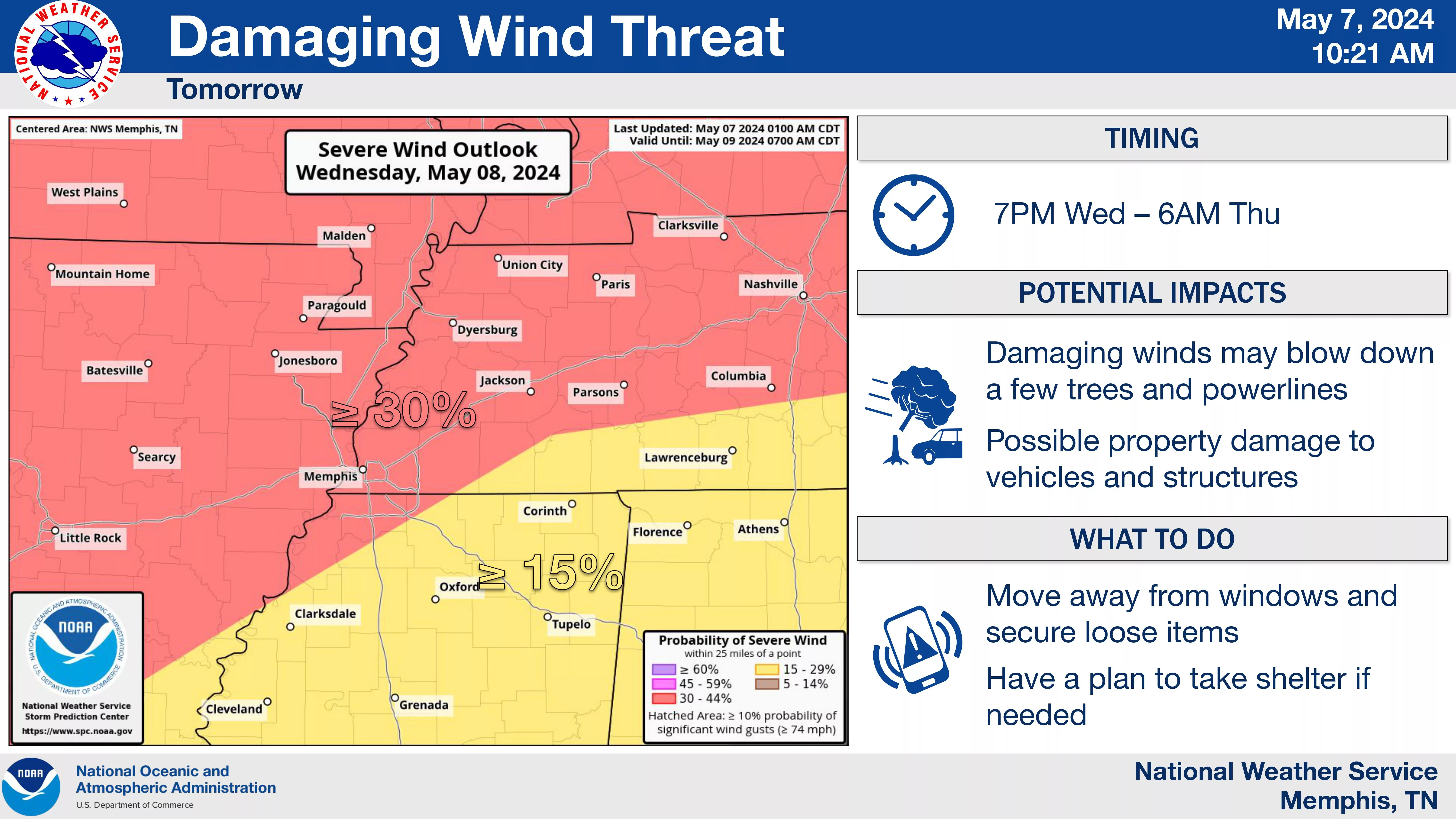
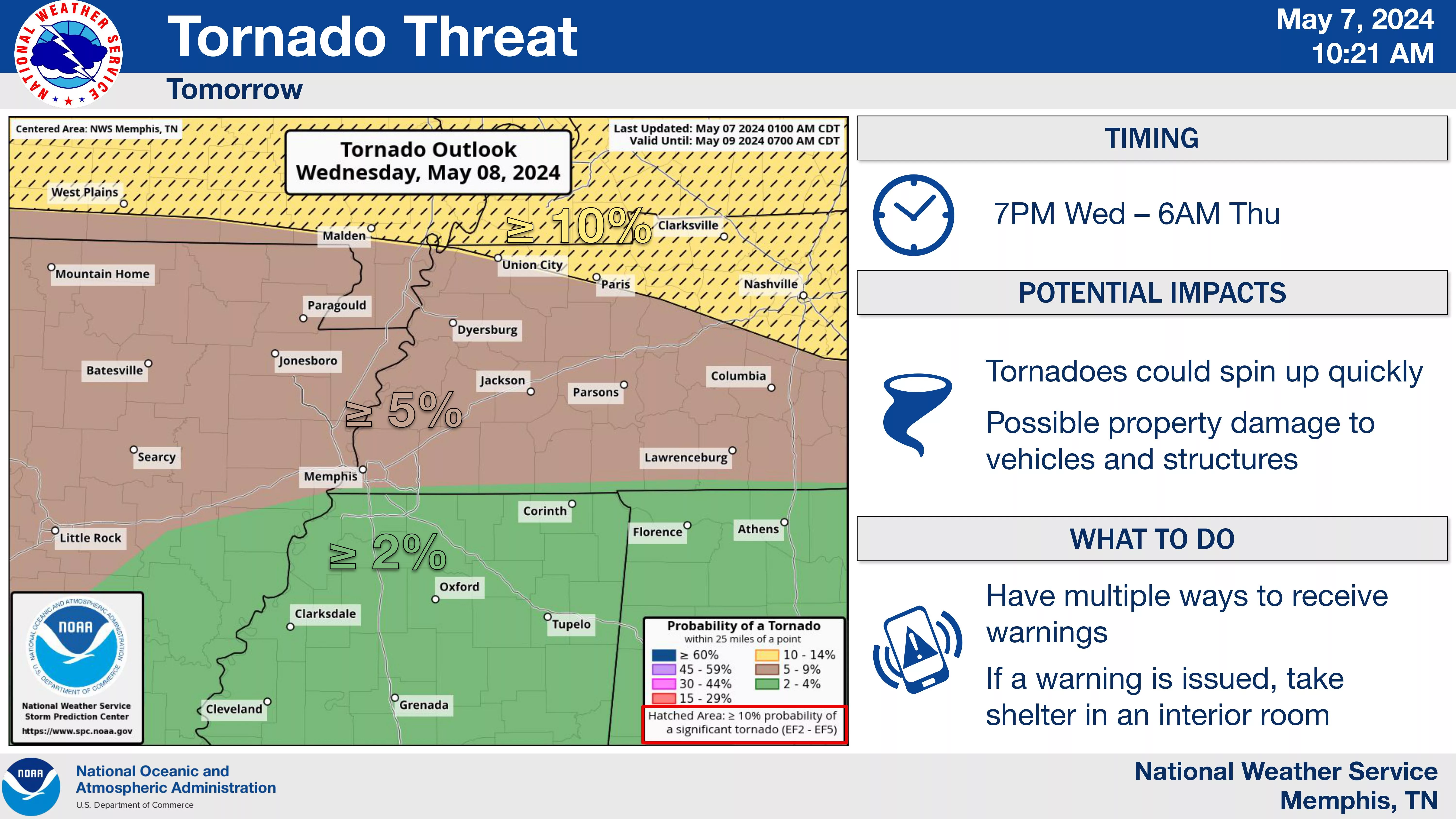
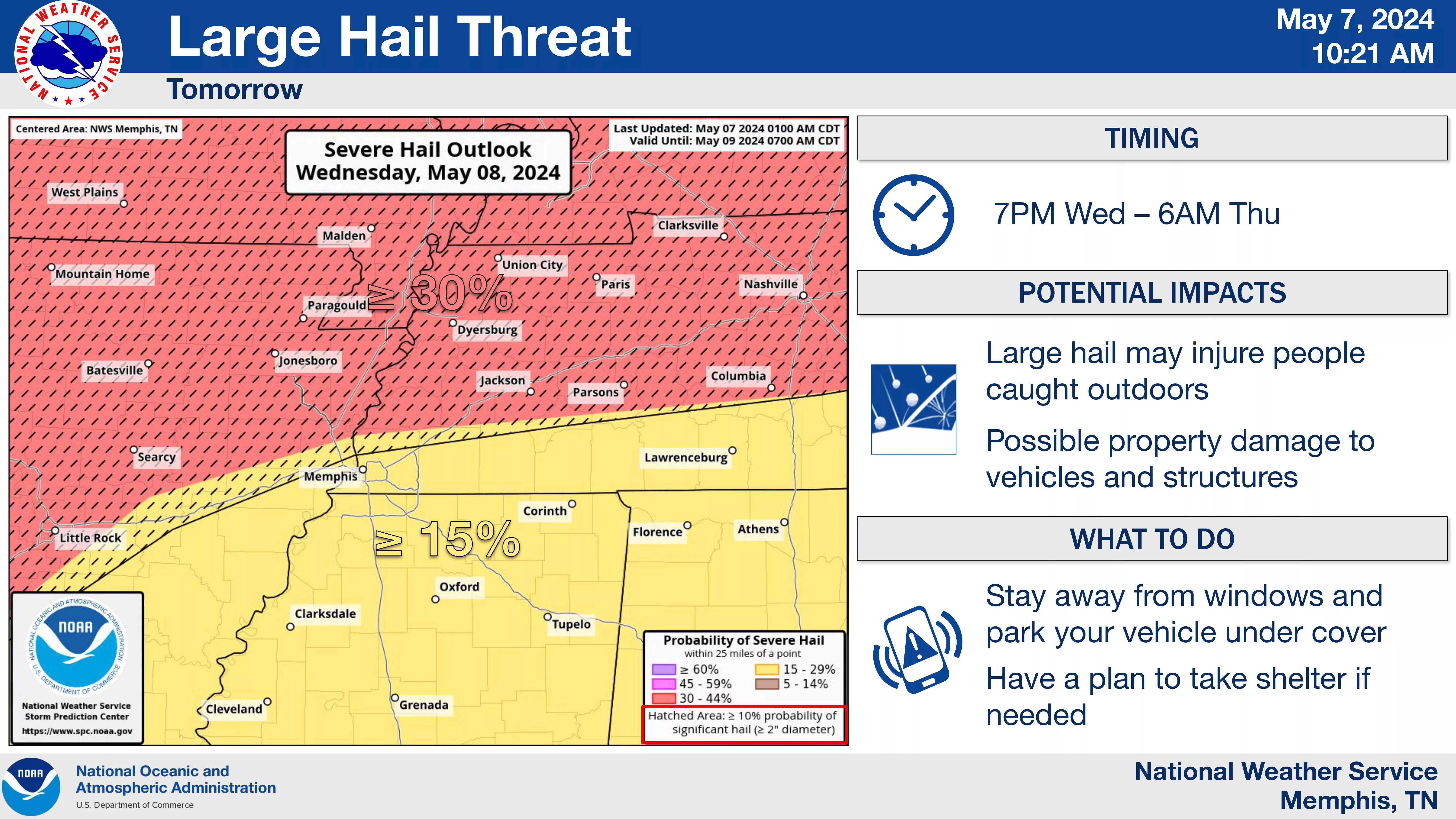
Multiple rounds of severe weather will be possible over the next few days, especially late Wednesday evening, according to a Tuesday morning briefing by the National Weather Service in Memphis.
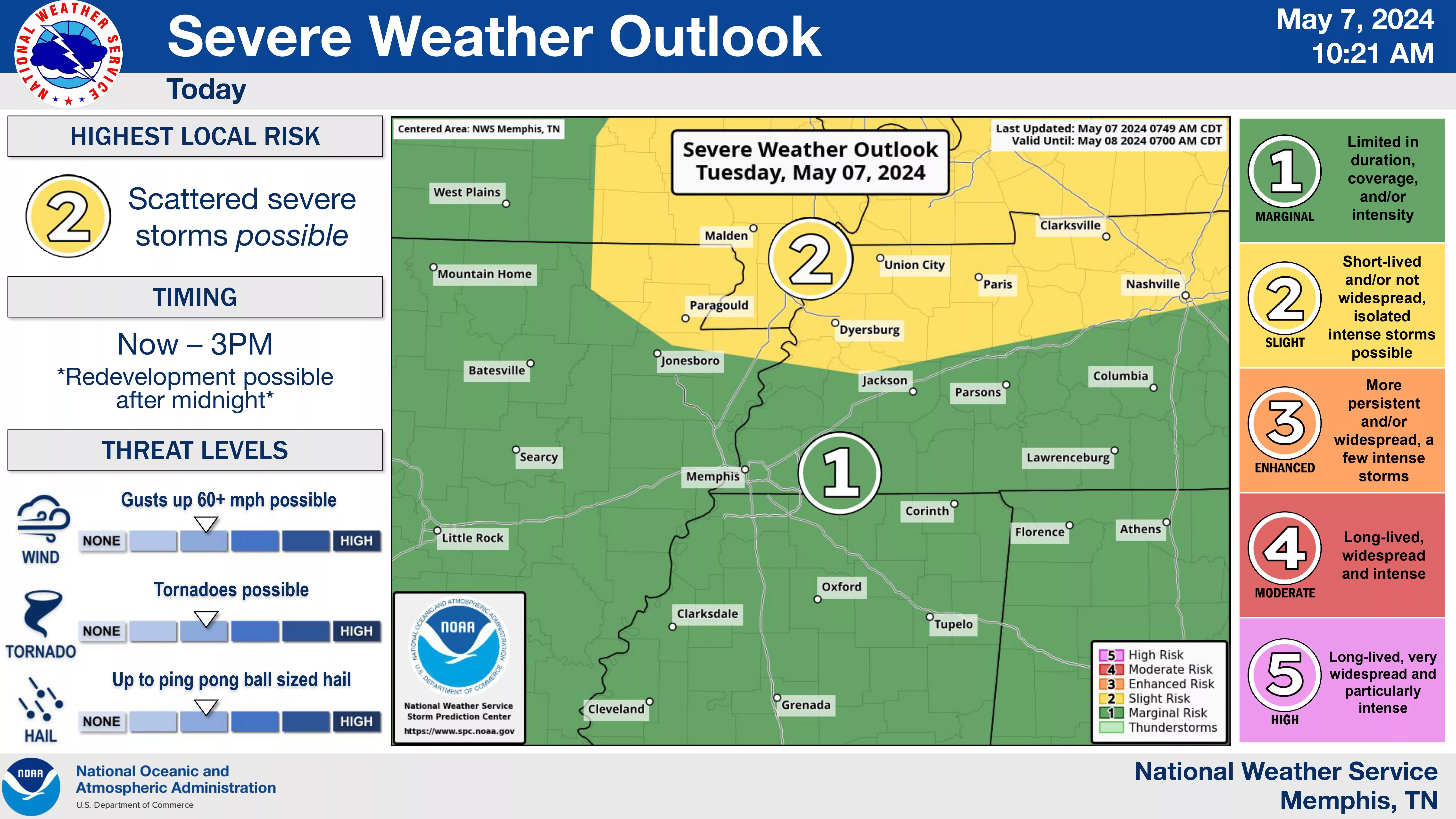
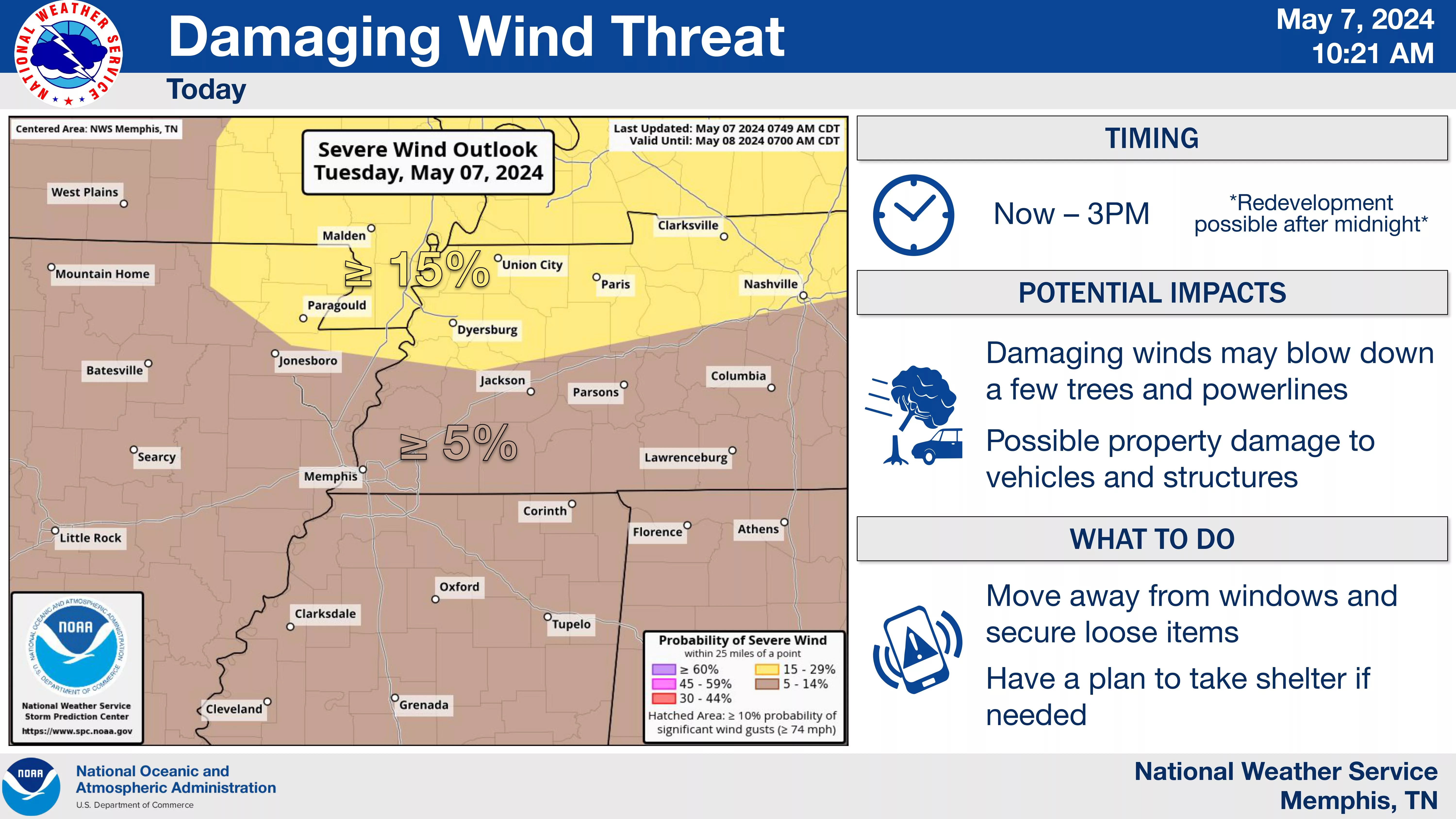
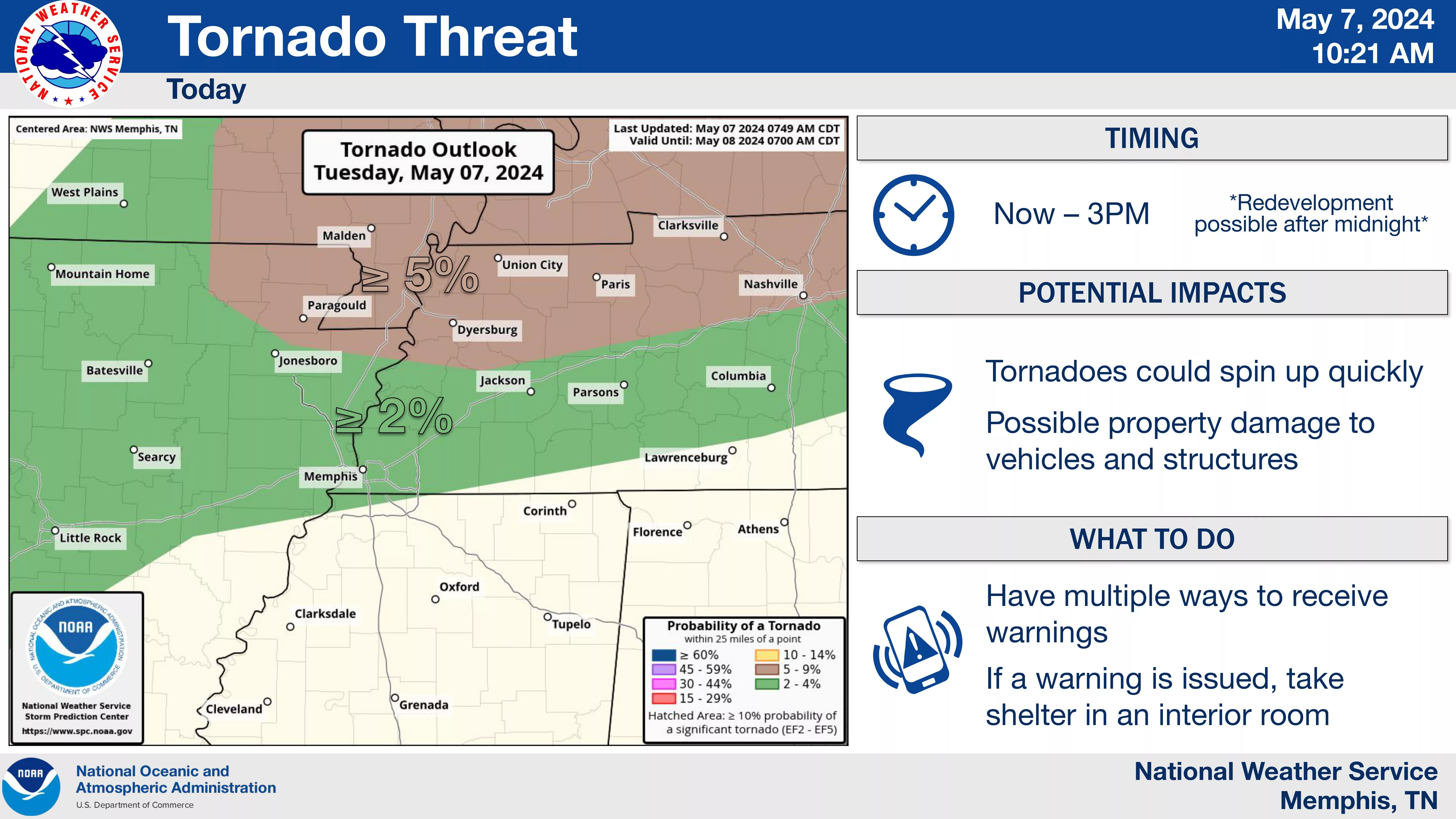
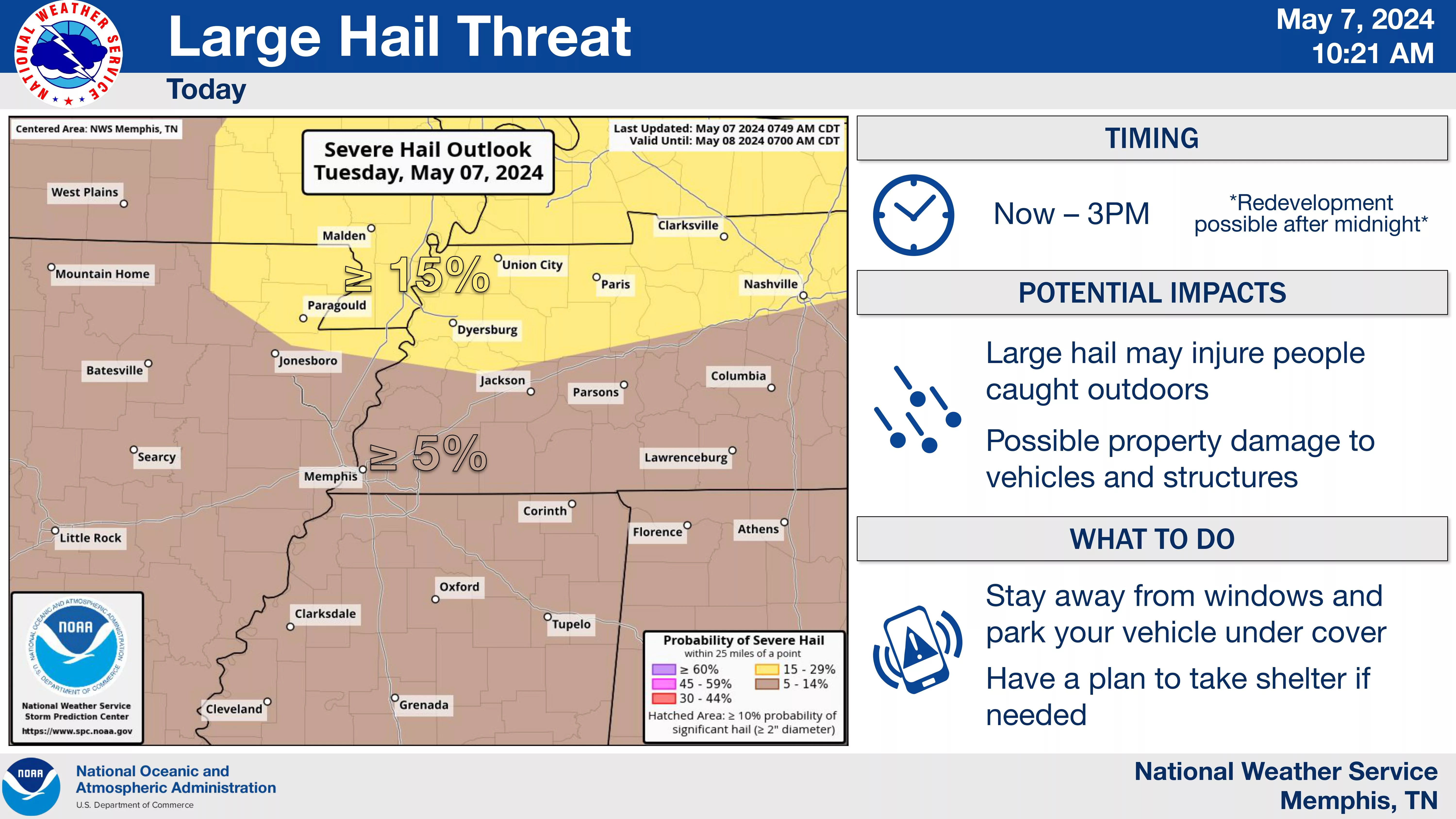
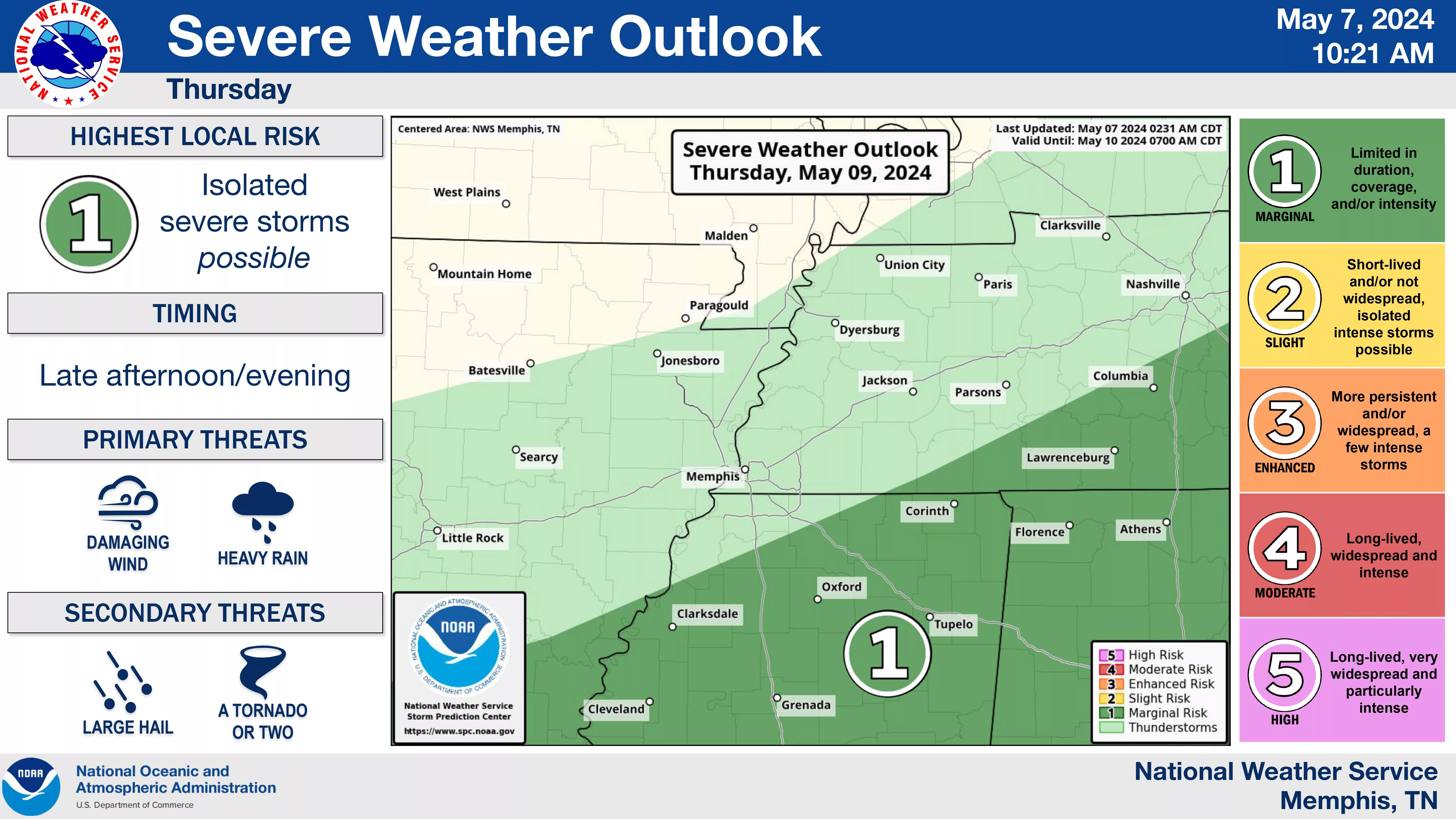
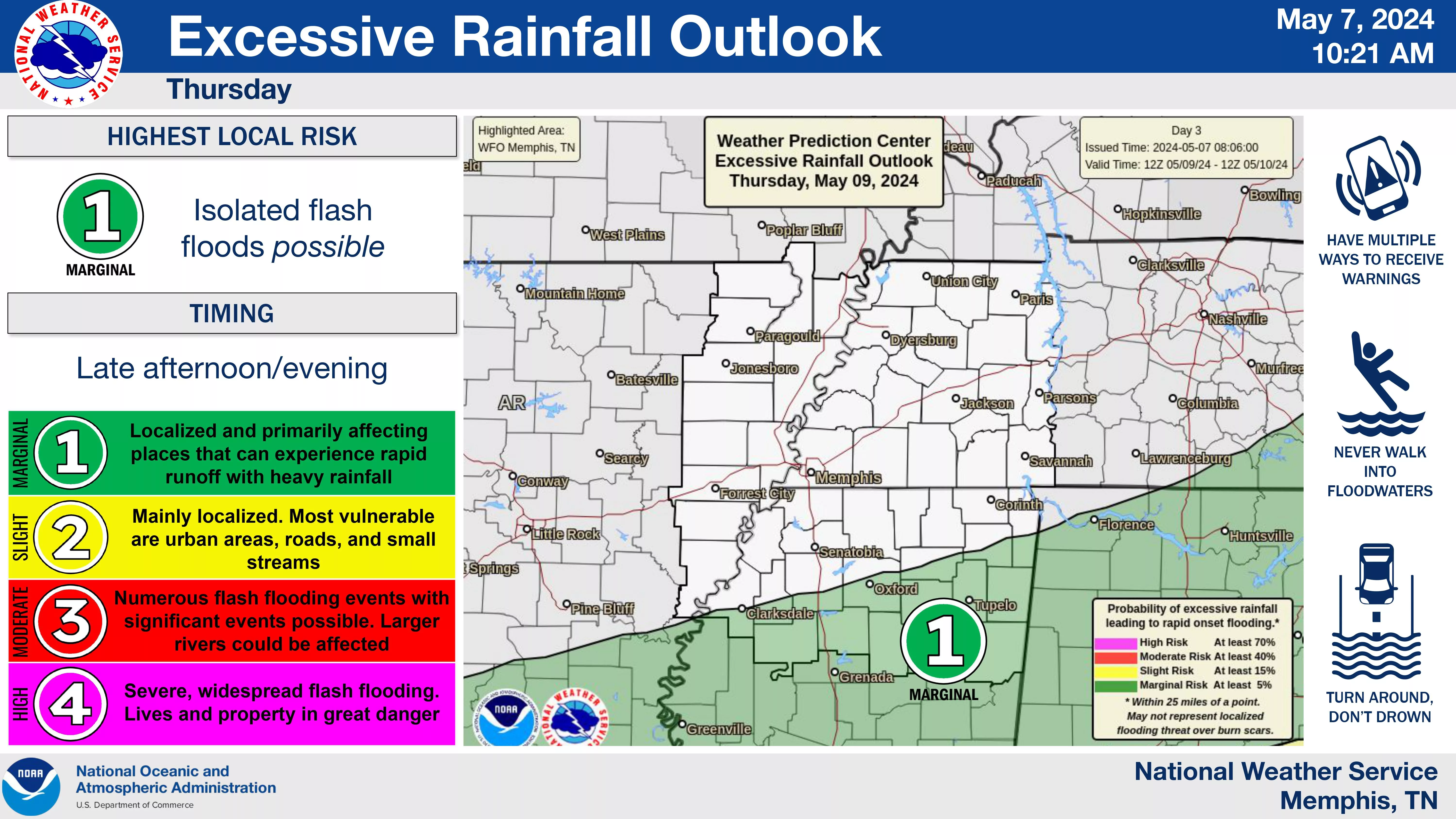
NWS said damaging winds and hail are the primary threats today (Tuesday, May 7, 2024) and Thursday, May 9, 2023. There’s a 2/5 slight risk of severe weather today and a 1/5 marginal risk Thursday.
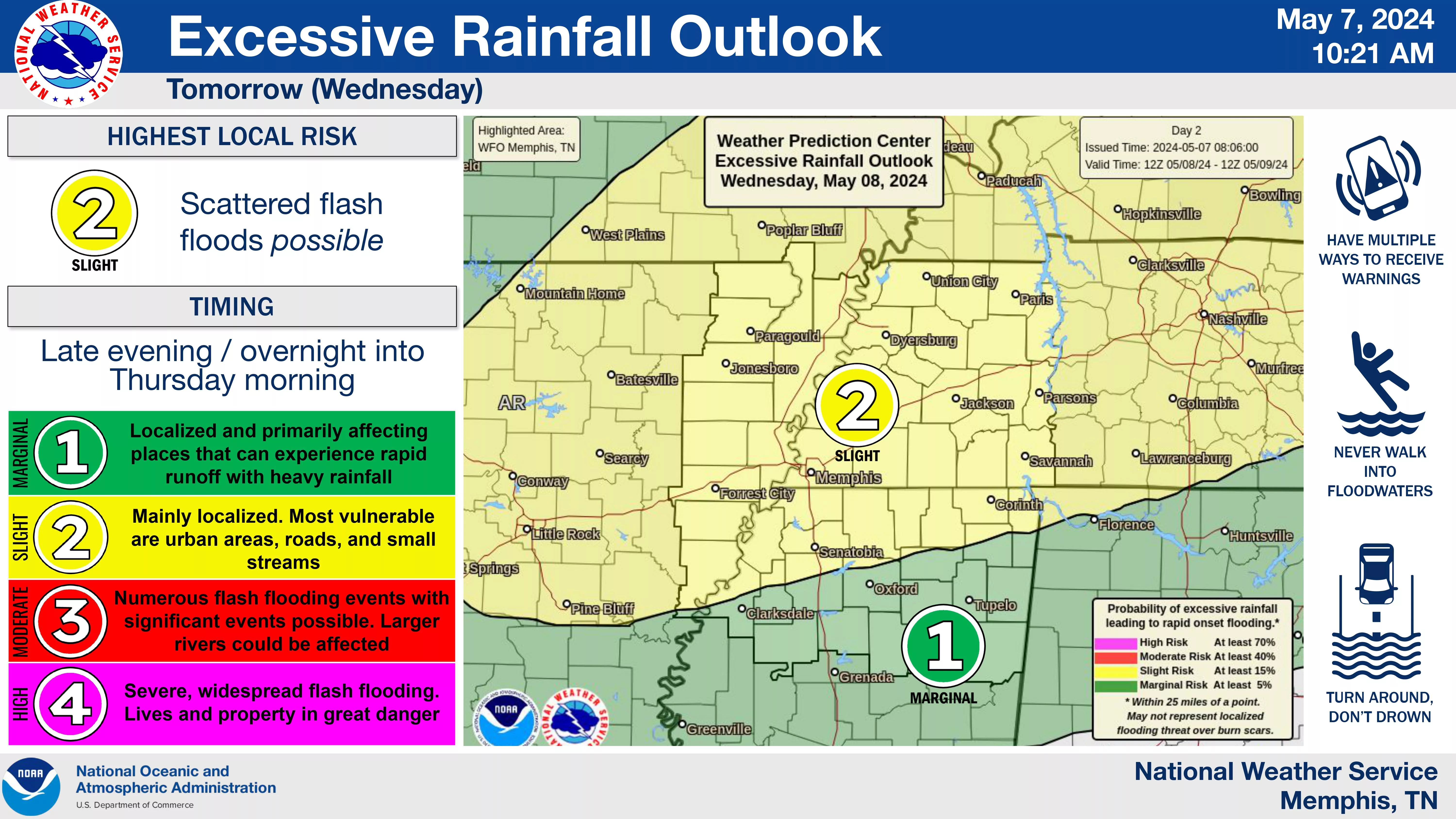
The tornao threat is higher the evening of Wednesday, May 8, 2024, and very large hail will also be possible. There’s a 3/5 enhanced risk for severe weather Wednesday evening.
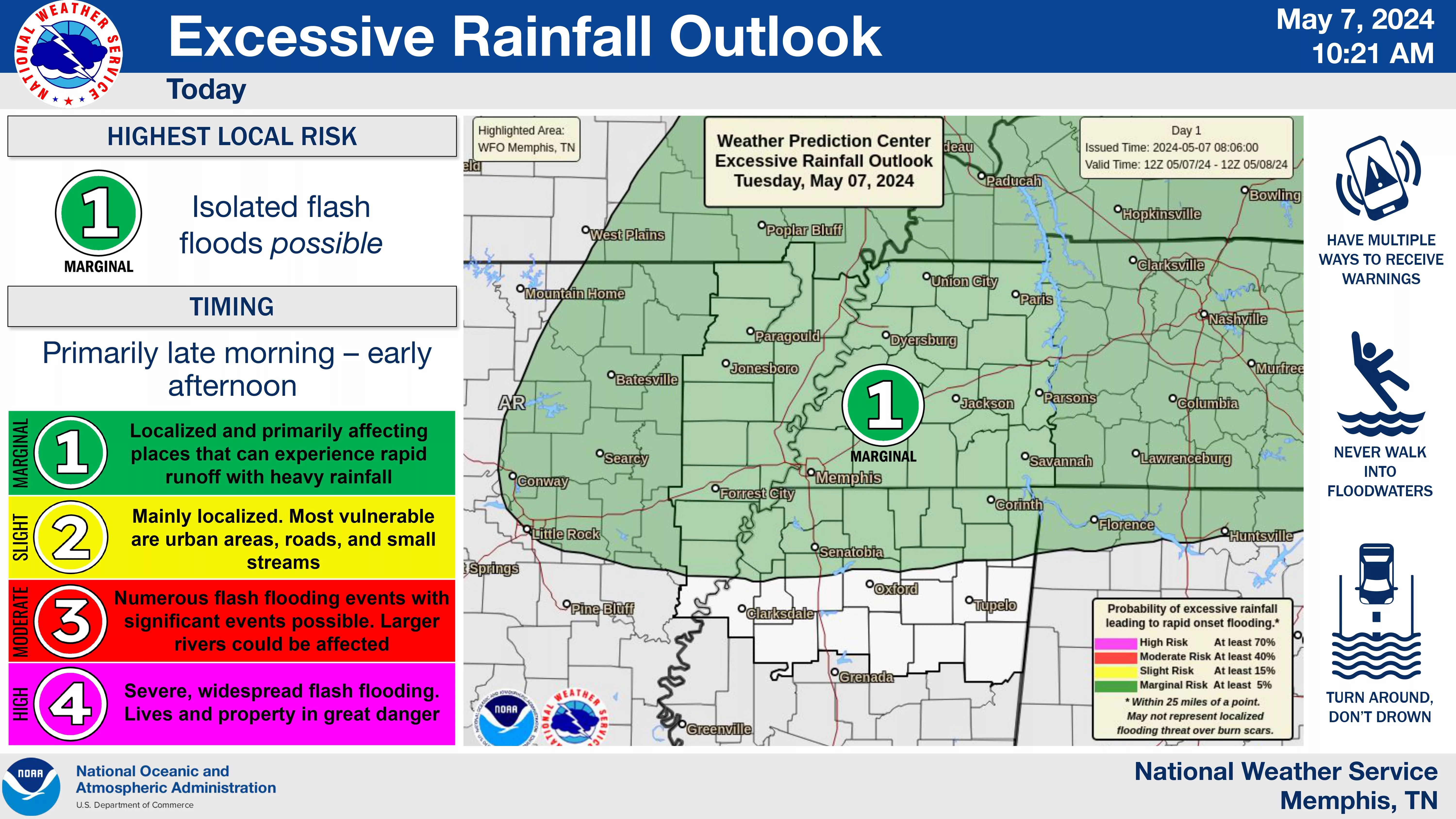
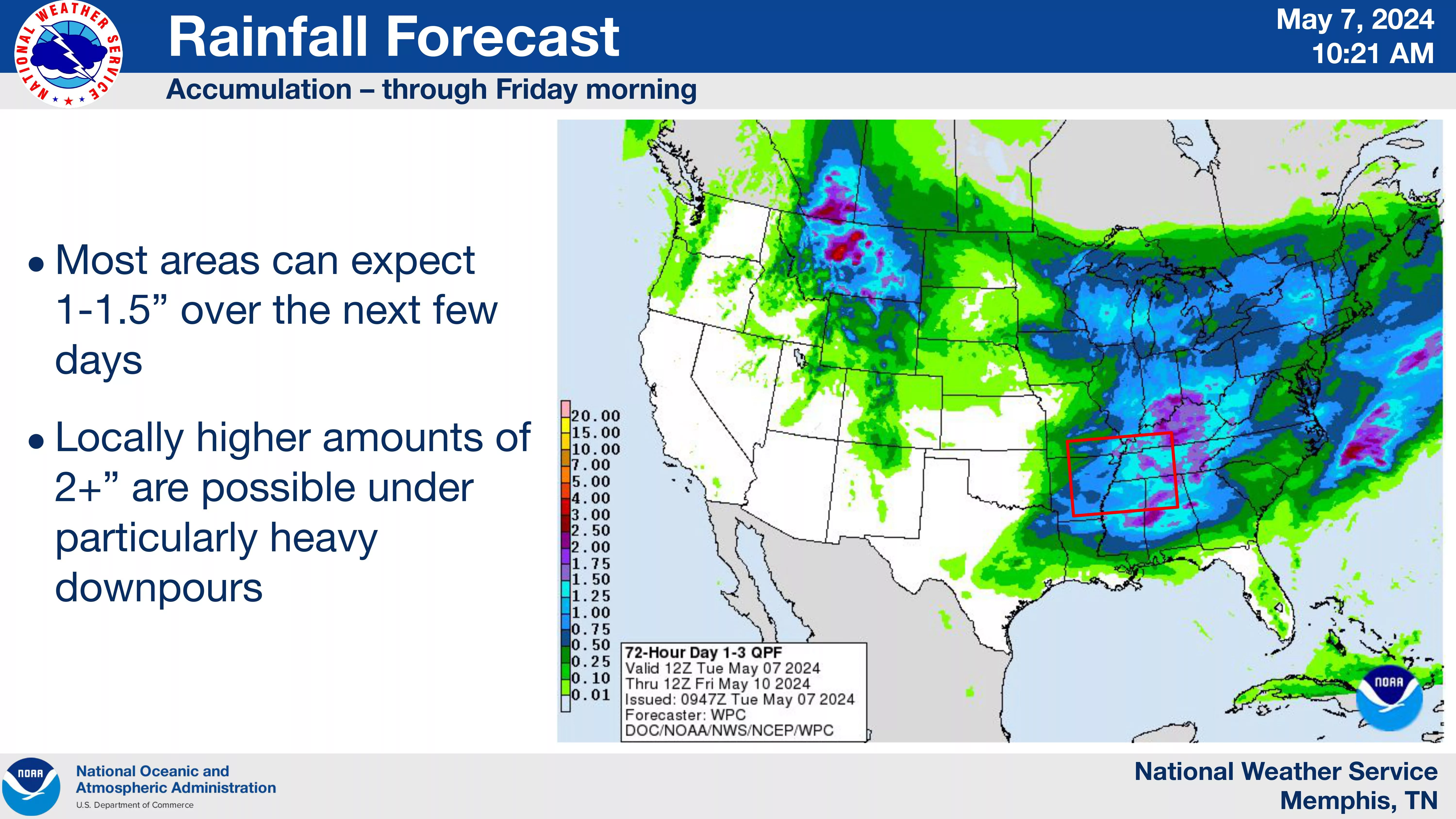
Also, 1-2 inches of rainfall is xpected through the morning of Friday, May 10, 2024, with locally higher amounts and the heaviest rainfall Wednesday evening.
NWS said the most likely/impactful period of severe weather is overnight Wednesday and to make sure your watch/warning reception method can wake you up!
Our severe weather coverage is sponsored by Lindsey Electric, your Generac generator dealer in Jackson. Call 731-423-1580, or visit Lindsey Electric Service dot com. Lindsey Electric – The authority for your power solutions.