Logo courtesy of Lindsey Electric; Radio 731 logo courtesy of Forever Communications; Image, Shutterstock
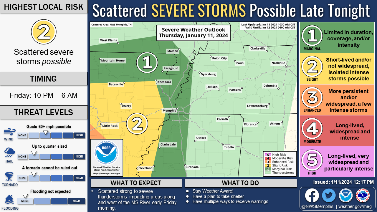
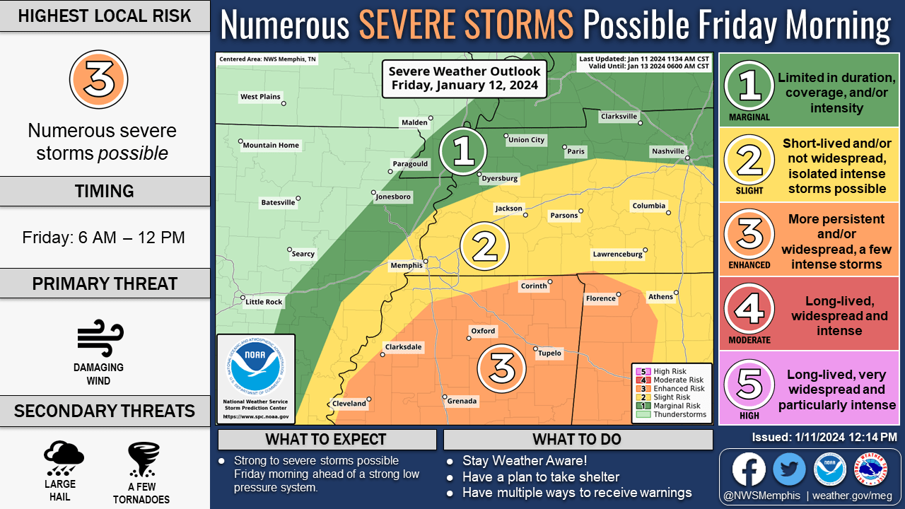
“There is an increasing risk for severe weather across the Mid-South tonight through Friday morning as a strong low-pressure system moves across the region,: according to Mike Johnson, Science and Operations Officer (SOO) for the National Weather Service in Memphis.
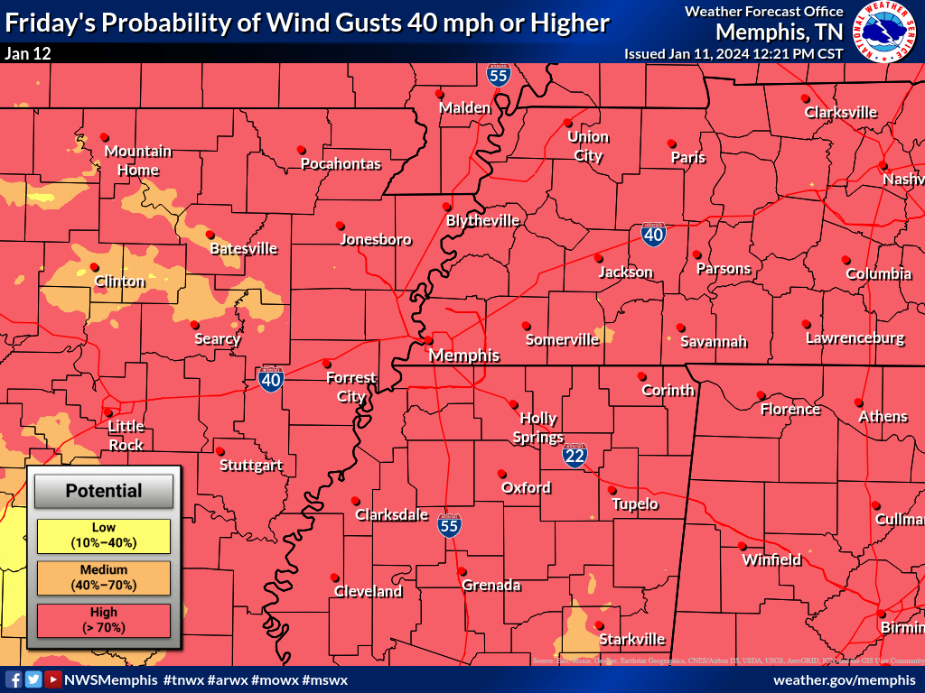
“Ingredients are coming together to support a complex of storms tonight into Friday, supportive of damaging wind and large hail. Instability is the key to this forecast. If instability is sufficient for surface-based storms, the severe potential will increase, along with a threat for a few tornadoes. If instability remains limited, the severe weather threat will be lower. The greatest risk for severe thunderstorms will be along and south of Interstate 40, though there is a potential across nearly all of the Mid-South. Outside of thunderstorms, gusty winds are expected to develop with gusts to near 50 mph at times late tonight and Friday.”
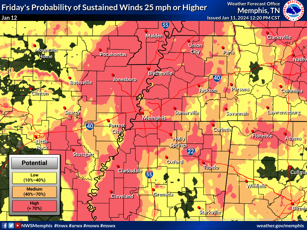
NWS has also continued a WIND ADVISORY, which will remain in effect from 3 a.m. Friday, January to 12 a.m. Saturday, January 13.
Southwest winds 25 to 35 miles per hour with gusts up to 55 miles per hour are expected.
This advisory is for portions of East Arkansas, North Mississippi, Southeast Missouri and West Tennessee.
NWS said gusty winds could blow around unsecured objects. Tree limbs could be blown down and a few power outages may occur.
Due to saturated grounds and a second round of strong winds this week, several downed trees and scattered power outages are possible.
PRECAUTIONARY/PREPAREDNESS ACTIONS…
Use extra caution when driving, especially if operating a high profile vehicle. Secure outdoor objects.